


WindSat Rainfall Products
 |
Sensor Description:
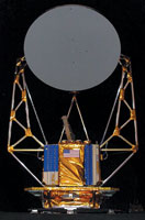
WindSat is a multifrequency polarimetric microwave radiometer designed to demonstrate the capability of polarimetric microwave radiometry to measure the ocean surface wind vector from space. It has 22 channels operating at 5 frequencies. All frequencies have both v and h polarizations and three of the channels also have +/-45, left-hand circular, and right-hand circular polarizations. The instrument scans both fore and aft and while some frequency bands have a swath width greater that 1200 km, the common swath width is approximately 950 km (68 degrees of scan angle) and the aft common swath is 350 km (23 degrees of scan angle). It was launched on board the U.S. Dept. of Defense Coriolis satellite on January 6, 2003 into an 840 km circular sun-synchronous orbit.
Algorithm Description:
GPROF algorithm description
The rainfall algorithm used to compute rainfall estimates from the
WindSat brightness temperature data is version 7 of the Goddard
PROFiling algorithm (GPROF) [Kummerow et al., 2001]. Note that this
version corresponds to version 6 of the GPROF algorithm applied to
the TRMM TMI data.
Input Brightness Temperature Data:
The rainfall products provided here are computed from the Level 1C brightness temperature dataset.Data Availability:
Rainfall estimates are not yet available from WindSat. We hope to
start producing WindSat rainfall products soon beginning with the
current start of our WindSat data archive on June 29, 2006.
WindSat -> June 29, 2006 – Present
Rainfall Data:
Gridded daily and monthly rainfall maps will be produced for
the period specified above. These data are stored as byte values
in a binary data format to minimize storage/data transfer
requirements and avoid byte swapping issues between different
computer systems.
FTP Rainfall Data
Daily Gridded Rainfall Files Format
Monthly Gridded Rainfall Files Format
Rainfall Images:
Browse images in png format have been created for both the daily
and monthly gridded rainfall data products.
Create Daily Rainfall Images
Create Monthly Rainfall Images
FTP Pre-rendered Rainfall Images
Software:
Software to read the binary data files is available in both C and
IDL.
Get software
Additional Documentation/References:
| – | Kummerow, C., Y. Hong, W. S. Olson, S. Yang, R. F. Adler, J. McCollum, R. Ferraro, G. Petty, D. B. Shin, and T. T. Wilheit, 2001: The evolution of the Goddard profiling algorithm (GPROF) for rainfall estimation from passive microwave sensors, J. Appl. Meteor., 40, 1801-1820. |
Related Links:
Naval Research Laboratory
NASA Jet Propulsion Laboratory